Reading Neighborhoods Like a Traveler: How to Interpret New Places on the Go
Landing in a new city, the first challenge is often figuring out which parts of a neighborhood feel welcoming, safe, and accessible—especially when every street looks unfamiliar. Instead of relying on vague hunches or tourist clichés, you can learn to read a neighborhood as you travel, using cues from the street, local rhythms, and a bit of practical preparation. This guide walks you through a hands-on, step-by-step approach to navigating and understanding neighborhoods on the move, with an eye toward accessibility and safety for every kind of traveler.
You’ve just arrived in a city you’ve never visited before. Maybe you’re rolling your suitcase down the sidewalk, or you’re behind the wheel looking for a place to park. Every block seems different—some lively, some deserted, some inviting, some a bit confusing. How do you decide where to pause, where to explore, and which streets are best avoided? Reading a neighborhood while traveling isn’t just about avoiding trouble; it’s about making the most of your trip, moving with confidence, and ensuring your route works for your needs—whether you’re traveling with a stroller, a wheelchair, or just a backpack. This skill becomes even more important if you’re road-tripping, arriving late, or adjusting plans due to weather or local events.
Start Before You Arrive: Mapping Anchors and Obstacles
The groundwork for reading a neighborhood starts well before your arrival. Before setting out, use official city or tourism maps to spot major landmarks—these are your anchors, like train stations, central plazas, or key intersections. Mark out potential barriers as well: rivers, highways, rail lines, or construction zones can all shape how you move through a place. If you’re traveling by car, check for one-way streets and parking options. For travelers with accessibility needs, look for information about step-free access or curb ramps. Download offline maps in case cell service drops. Remember, maps can lag behind reality: construction, festivals, or weather events might close off routes without warning. Always plan a couple of alternative paths, especially if you’re traveling during busy seasons or in storm-prone areas.
First Impressions: What to Notice on Arrival
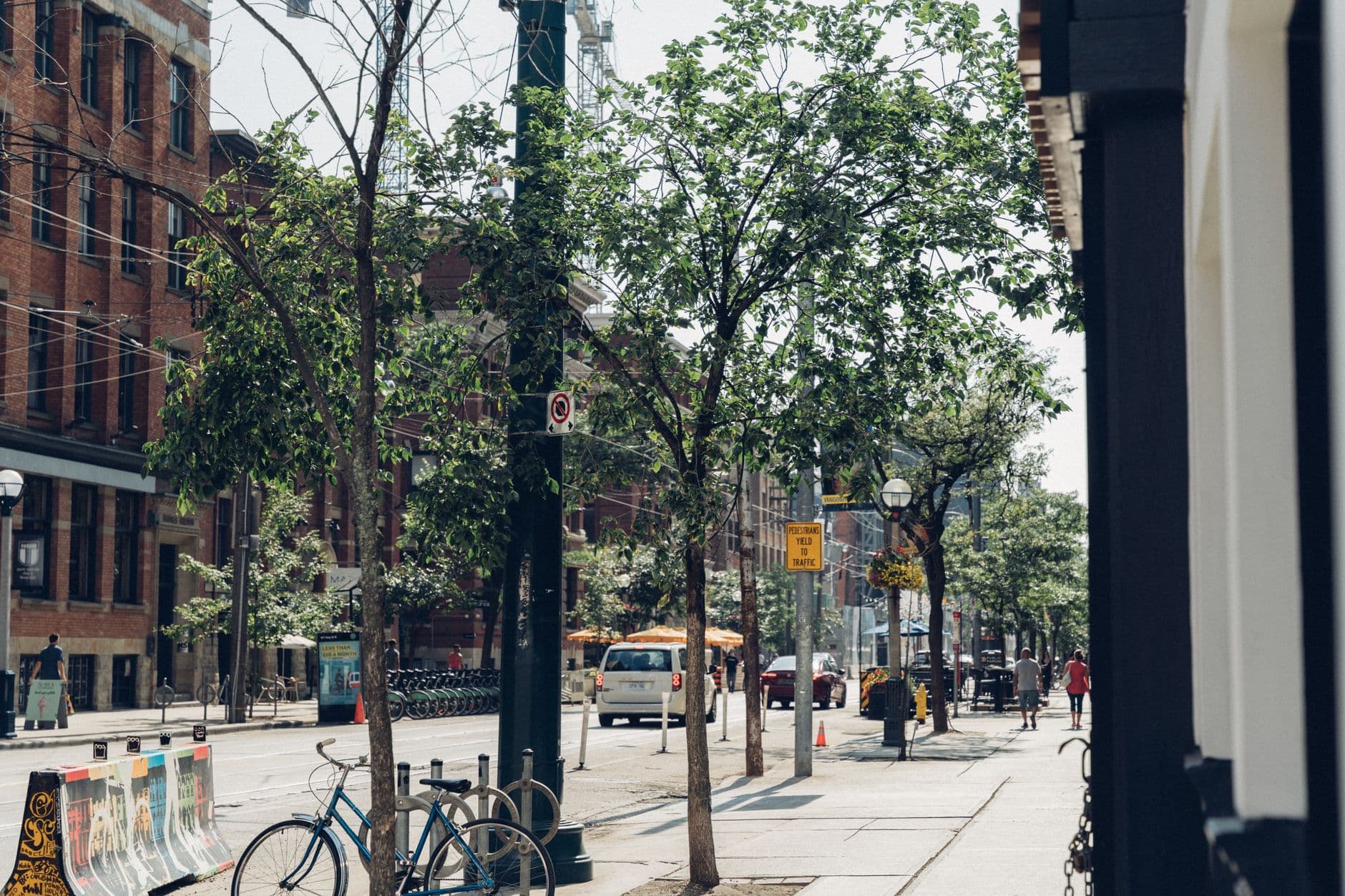
As you step into a new neighborhood, take a moment to look around and listen. Are there people out and about—families, seniors, kids, street vendors? Are businesses open and active, or do most shops have their shutters down? Wide, well-lit sidewalks and visible signage can make navigation easier and signal a welcoming environment. Notice how people use the space: Are folks walking dogs, chatting at benches, or moving quickly with heads down? These clues reveal how comfortable locals feel and can help you decide where to linger or move on. If you arrive late at night or during a local holiday, don’t assume a quiet street is unsafe—but do double-check if you see signs of disrepair, broken lighting, or hurried movement.
Layering the Landscape: Edges, Corridors, and Hidden Pockets
Neighborhoods aren’t just a jumble of streets—they have structure. Start by identifying the edges: natural or built boundaries like rivers, parks, or major roads that define where the neighborhood begins and ends. Next, look for corridors—main streets or boulevards where most of the action happens. These usually have the most shops, transit stops, and foot traffic. Finally, explore the pockets—side streets, residential blocks, or small parks tucked away from the main flow. These quieter areas often hold local cafes, community gardens, or playgrounds. Knowing this basic structure helps you orient yourself, find accessible paths, and avoid getting lost. If you’re unsure which streets are best for walking or rolling, ask a local shopkeeper or look for areas with benches and open storefronts.
Using Public Spaces to Pause and Regroup
Parks, plazas, and transit hubs aren’t just for sightseeing—they’re perfect places to stop, check your bearings, and decide your next move. If you ever feel uncertain, seek out one of these public spaces. They often have maps, information desks, or at least a safe spot to sit and observe. For travelers with mobility needs, larger parks and plazas are more likely to have accessible restrooms and step-free paths. If a public space feels deserted or poorly maintained, trust your instincts and look for a livelier area. These spots can also serve as meeting points if you get separated from your group.
Keeping an Eye on Changing Conditions
Neighborhoods can change quickly—what feels lively in the afternoon might be deserted at night, or a bustling street could empty out during a rainstorm or festival. Always be ready to reassess your route. If you notice businesses closing early, crowds thinning, or weather worsening, it’s wise to head back toward a main corridor or your original anchor point. For longer trips, especially by car, plan for fatigue and take regular breaks to stay alert. If you feel drowsy or distracted, pull over in a safe, well-lit area—never try to push through tiredness, as it can affect your judgment and safety.
When to Ask for Help or Change Course
No matter how prepared you are, there will be times when you need more information. Don’t hesitate to ask for directions or advice from shopkeepers, transit staff, or people at information desks. If you run into unexpected barriers—like a sudden street closure, aggressive solicitation, or an area that feels uncomfortable—return to a known anchor or public space. If you’re traveling during severe weather or an emergency, follow local evacuation guidance and check official resources for updates. And if you ever feel unsafe or lost, trust your instincts and seek help rather than pressing on.
Checklist: Quick Cues for Reading a Neighborhood
Sometimes, a short mental checklist helps you stay oriented:
Are there people of varied ages and backgrounds out and about?
Are shops and cafes open and active?
Do sidewalks and crossings look accessible?
Is there clear signage for streets and transit?
Are public spaces clean and well-lit?
Do you see locals lingering, or does everyone seem to hurry through?
If most answers are positive, you’re likely in a comfortable, active area. If not, consider moving toward a busier or better-lit street, especially after dark or in unfamiliar places.
Traveling with Accessibility in Mind
If you or someone in your group has mobility or sensory needs, neighborhood reading becomes even more important. Before setting out, check official resources for accessibility info—look for details on curb cuts, step-free entrances, and accessible restrooms. On the ground, observe whether sidewalks are wide and well-maintained, and if public transit stops have ramps or lifts. Don’t hesitate to ask locals or staff about the best accessible routes. If you encounter barriers, reroute to main corridors or known accessible points. Many parks and public spaces, especially in larger cities, have dedicated accessibility features—these can be useful anchor points for breaks and navigation.
Staying Alert: Safety and the Unexpected
Even with the best preparation, distractions and fatigue can sneak up on you—especially on long travel days or road trips. Stay mindful of your surroundings and take breaks when you feel tired. If you’re driving, avoid using your phone or multitasking behind the wheel, and pull over if you need to check a map or rest. If an emergency arises, such as severe weather or a sudden evacuation, follow official instructions and move to a safe location as quickly as possible. Preparing for the unexpected is part of reading a neighborhood well: it lets you adapt to changes and keep your travel experience positive.
References
National Highway Traffic Safety Administration, Distracted Driving — referenced for guidance on staying alert and safe during long drives and while navigating new neighborhoods. https://www.nhtsa.gov/risky-driving/distracted-driving
National Highway Traffic Safety Administration, Drowsy Driving — used to reinforce the importance of managing fatigue when traveling and reading neighborhoods. https://www.nhtsa.gov/risky-driving/drowsy-driving
Ready.gov, Evacuation — provided language and recommendations for handling emergencies and evacuations during travel. https://www.ready.gov/evacuation
U.S. Customs and Border Protection, Travel — referenced for pre-trip considerations, especially for international travelers and entry requirements. https://www.cbp.gov/travel
Shoulder season city trips promise lower rates and thinner crowds, but closed attractions, spotty transit, and unpredictable weather can still derail plans. This guide covers the common failure modes—and concrete fixes for each.
Facing your first national park trip? This narrative walks through the nuts and bolts of planning a visit that’s accessible, safe, and adaptable. From choosing your park to handling last-minute weather or accessibility surprises, follow a realistic day-by-day approach for a stress-free adventure.
Historic districts tempt travelers with winding lanes, layered stories, and visual surprises at every turn. But packing too much into a single day—especially when walking—is a recipe for exhaustion, missed details, and accessibility frustrations. This troubleshooting editorial by Aria Lawson unpacks common failure modes in historic district walking itineraries and offers practical, accessible solutions for travelers who want memorable, manageable experiences. From overambitious schedules to packing errors and sensory overload, each section names a pitfall and shares actionable advice. Whether you’re planning your first stroll or refining your approach, these insights help you savor the past without overloading your present.
Coastal town off season travel brings quieter streets, friendlier locals, and a unique rhythm to destinations often swamped in summer. But planning an accessible, comfortable visit—especially with unpredictable weather and reduced services—requires a different approach. Here’s a realistic, step-by-step day in a coastal town outside peak season, with practical tips for packing, health, and accessibility, plus how to make the most of what’s open.
Landing in a new city can feel exhilarating—until you realize your hotel is stranded between highways or the ‘walkable’ neighborhood is more myth than reality. Choosing the right walkable hotel neighborhood isn’t just about convenience; it shapes your entire experience, from safety and accessibility to the freedom to explore on your terms. This troubleshooting guide unpacks common pitfalls and offers practical strategies so your next city adventure starts on the right foot.